Geotag Map Camera - GPS Camera Review
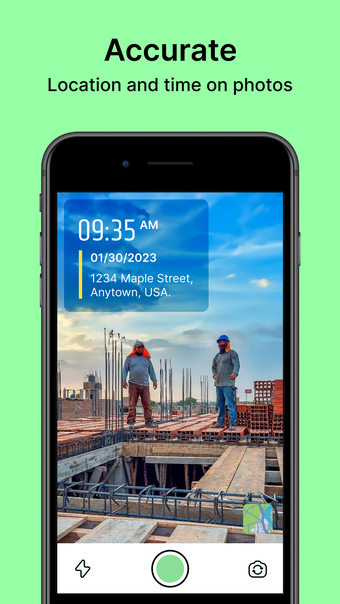
Geotag Map Camera - GPS Camera is an iPhone application that enhances your photo and video memories with detailed location and weather information. By utilizing this app, you can effortlessly add DateTime, map coordinates, altitude, weather conditions, magnetic field details, wind speed, and digital compass directions to your gallery media. Share your geotagged photos with family and friends to showcase your travel adventures. The latest update introduces new template categories like Travel, Vertical, Trending, and Weather, offering more creative options for users.
With Geotag Map Camera - GPS Camera, you can capture photos and videos with GPS coordinates, timestamp, and various geographical data. Stay informed about live weather conditions, temperature, humidity, wind speed, pressure, and altitude as you document your experiences. The app provides a seamless way to enrich your visuals with location-based information, making it easy to relive and share your global travel memories.


